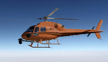
Precision Aerial Imaging and Geospatial Data Solutions
Achieving successful aerial acquisition in the dynamic New England environment demands meticulous mission planning, seamless sensor integration, and strict adherence to regulatory approvals. Helicopters Over Boston functions as your dedicated project command center, streamlining every phase of your operation. We meticulously assess your precise data or footage requirements, coordinate the ideal aircraft and experienced flight team for your specific mission profile, and manage all necessary flight planning and permits. This integrated approach provides you with a single point of accountability, delivering a comprehensive, turnkey result that exceeds expectations.
Cinema & Broadcast Videography
Elevate your visual storytelling with precision aerial cinematography solutions for feature films, commercials, and live broadcast events across Massachusetts. Helicopters Over Boston provides the stable, high-performance aerial platforms essential for Directors of Photography to capture breathtaking footage. We seamlessly integrate with industry-standard stabilization systems, including Shotover, Cineflex, and Tyler Mounts, and coordinate flawlessly with your production crew, ensuring perfect shot execution and delivering unparalleled cinematic results for your project.
Aerial Photography
Capture stunning, high-resolution aerial imagery that elevates your marketing assets, enhances real estate portfolios throughout Boston, and meticulously documents project progress. The experienced flight teams conducting these missions possess a deep understanding of optimal lighting, strategic angles, and precise composition. This expertise ensures the delivery of magazine-quality stills that make a lasting impact.
LiDAR & Geospatial Surveying
We provide critical geospatial data beyond visual perspectives, empowering projects across Boston and beyond. Our services include LiDAR acquisitions, orthomosaic mapping, and detailed 3D terrain modeling, which are essential for sophisticated urban planning, thorough utility inspections, and precise environmental monitoring efforts.
Utility & Asset Inspection
Achieve rapid, detailed inspections of critical infrastructure, from transmission lines to cell towers across Massachusetts. Our precise helicopter operations deliver the stable hover and flight accuracy essential for high-fidelity asset auditing, ensuring infrastructure integrity and reducing downtime.
Technical FAQ
Our platforms are expertly configured for all major industry camera mounts, including Shotover (F1, K1), Cineflex, and Wescam. For productions with lighter cinema payloads, we also support Tyler Minigyro and Middle mounts, ensuring versatile aerial cinematography solutions for your project.
We meticulously manage all airspace authorizations and flight plans essential for urban operations in and around Boston. Expert aviation personnel are proficient in navigating complex controlled airspace, ensuring your aerial project is executed legally and safely while securing the precise visuals you require.
We provide flexible solutions, from a comprehensive turnkey service including a skilled sensor operator, to accommodating your dedicated creative team. Should your crew join, we ensure thorough safety briefings and clear air-to-ground coordination protocols for a secure and efficient operation, delivering optimal results.
We deliver diverse data formats, including raw point clouds (LAS/LAZ), high-resolution orthomosaic maps (TIFF/ECW), or processed 3D meshes, based on your sensor payload. We collaborate with your GIS team to guarantee seamless file compatibility, ensuring immediate utility for your critical projects.
Gallery

Aerial Photography

Camera Equipment
Camera Mounts

Damage Survey

Real Estate Survey

Aerial Videography
Comprehensive Aerial Photography and Videography Solutions in Boston
For expert helicopter aerial photography services in Boston, call Helicopters Over Boston at 1-855-445-8965. Receive a fast, no-obligation quote for your project.